Weekend Walk – Bishops Sutton and Gundleton

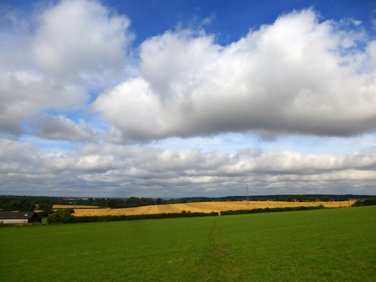
Scenes during a walk in late autumn, from Bishops Sutton near Alresford, to Gundleton and back.


An old granary at the northern edge of Bishops Sutton, perched on staddlestones to keep it drier and relatively rodent-proof:


Granary


A new house (Southview) built next to the Watercress Line. This is looking west:Watercress Line, Bishops Sutton


Watercress line from Bighton Lane, looking east:Watercress Line, Bishops Sutton

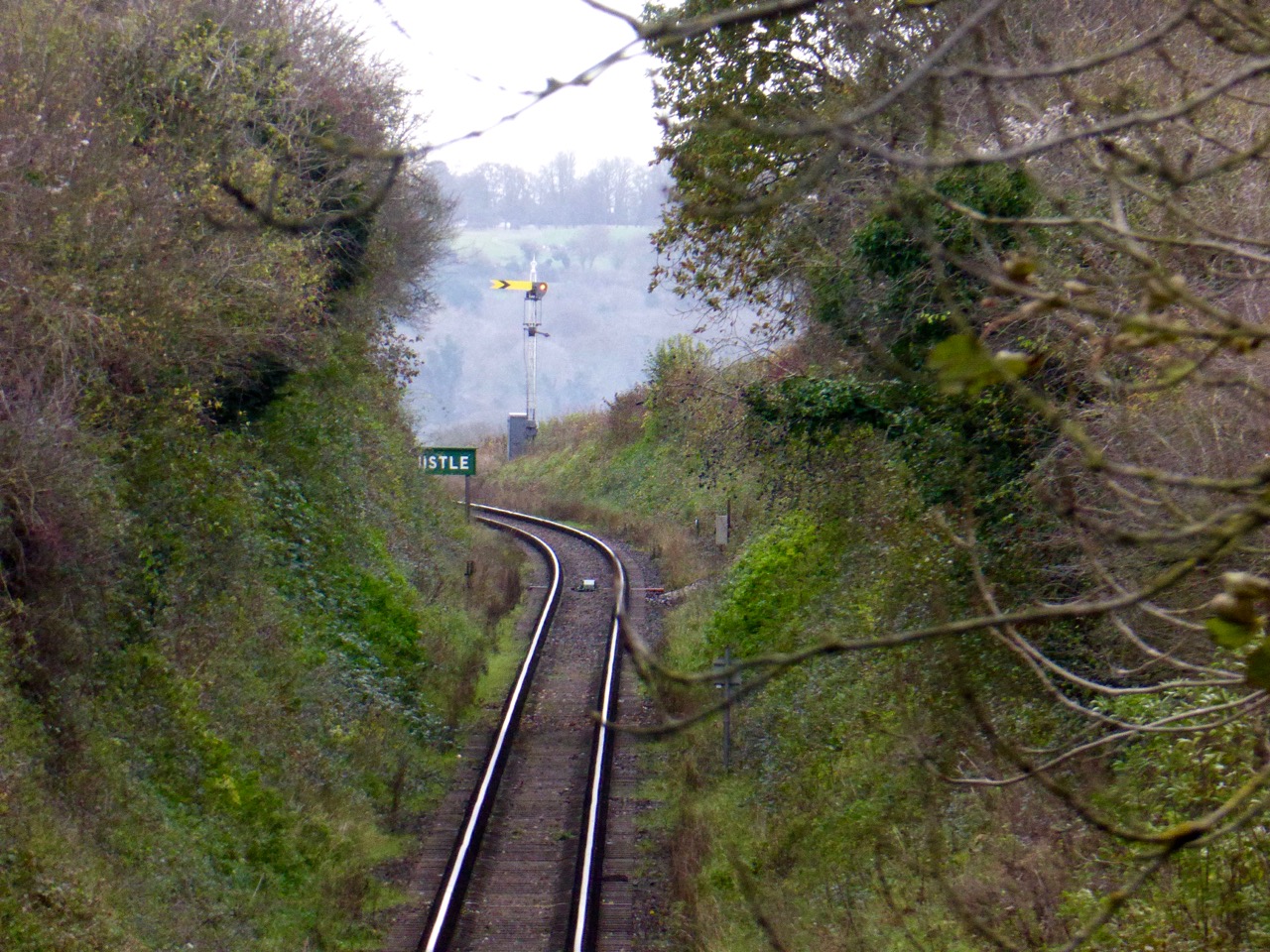
A dovecote in a scruffy garden near the railway: Dovecote, Bishops Sutton

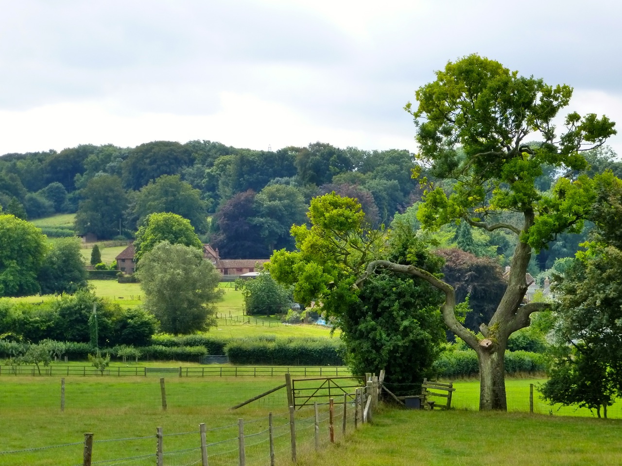
View from Bighton Lane to Northside Farm and Sutton Wood:Bighton Lane

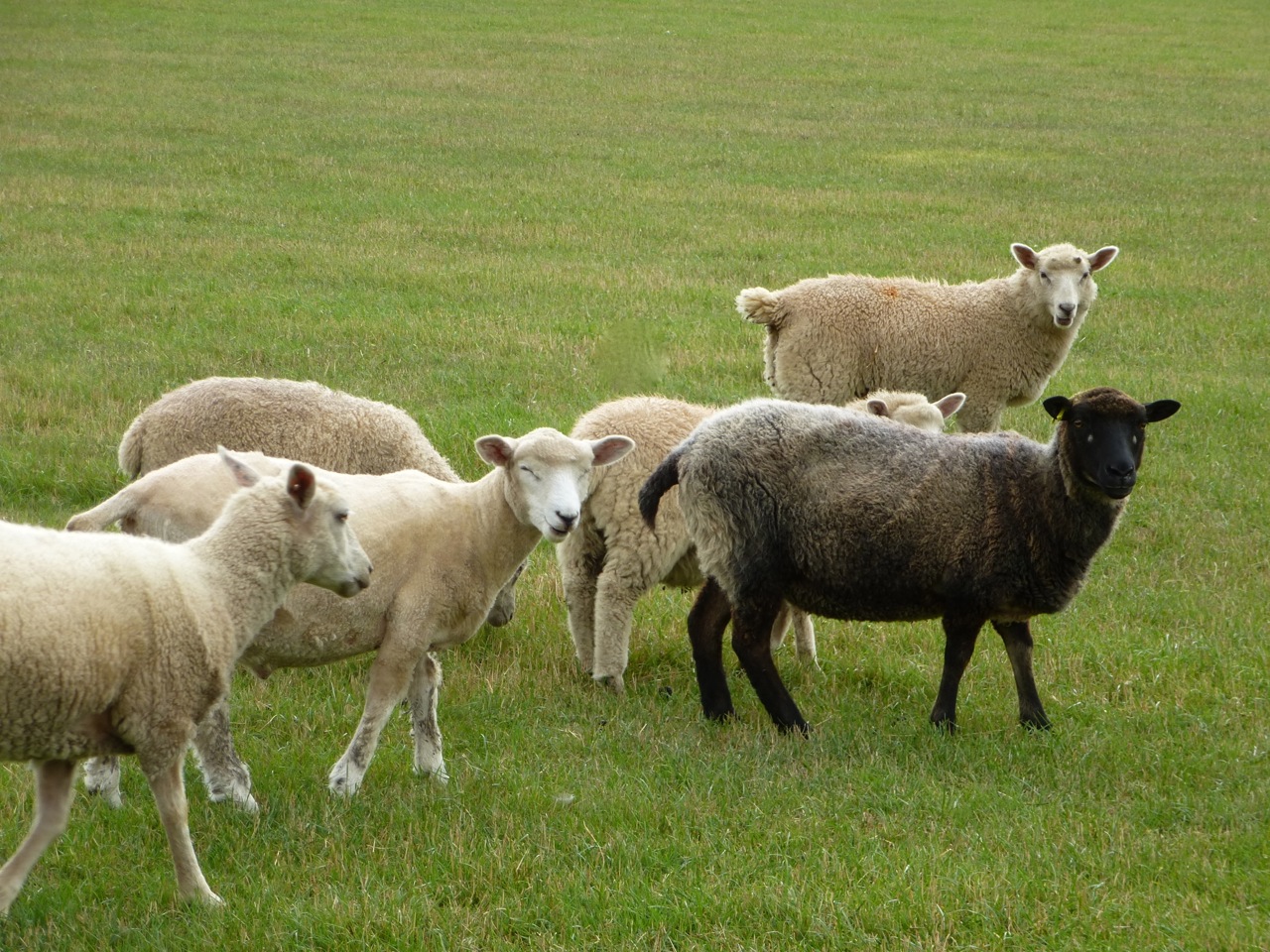
Geese and cows at Cliveden Farm, Gundleton:Geese at Cliveden, Gundleton

Cliveden. And I thought all of this part of Hampshire was super-expensive:Cliveden, Gundleton

Feeding the horses near Gundleton. They were very hungry. C fetched them fresh grass and I pushed the fallen hay to their side of the fence: Feeding the horses

Into an autumnal Sutton Wood:

Sutton Beech Wood, Gundleton

Out of the wood, looking west. The familiar landmark of Great Clump, Cheesfoot Head in the distance:Northside Farm, Gundleton

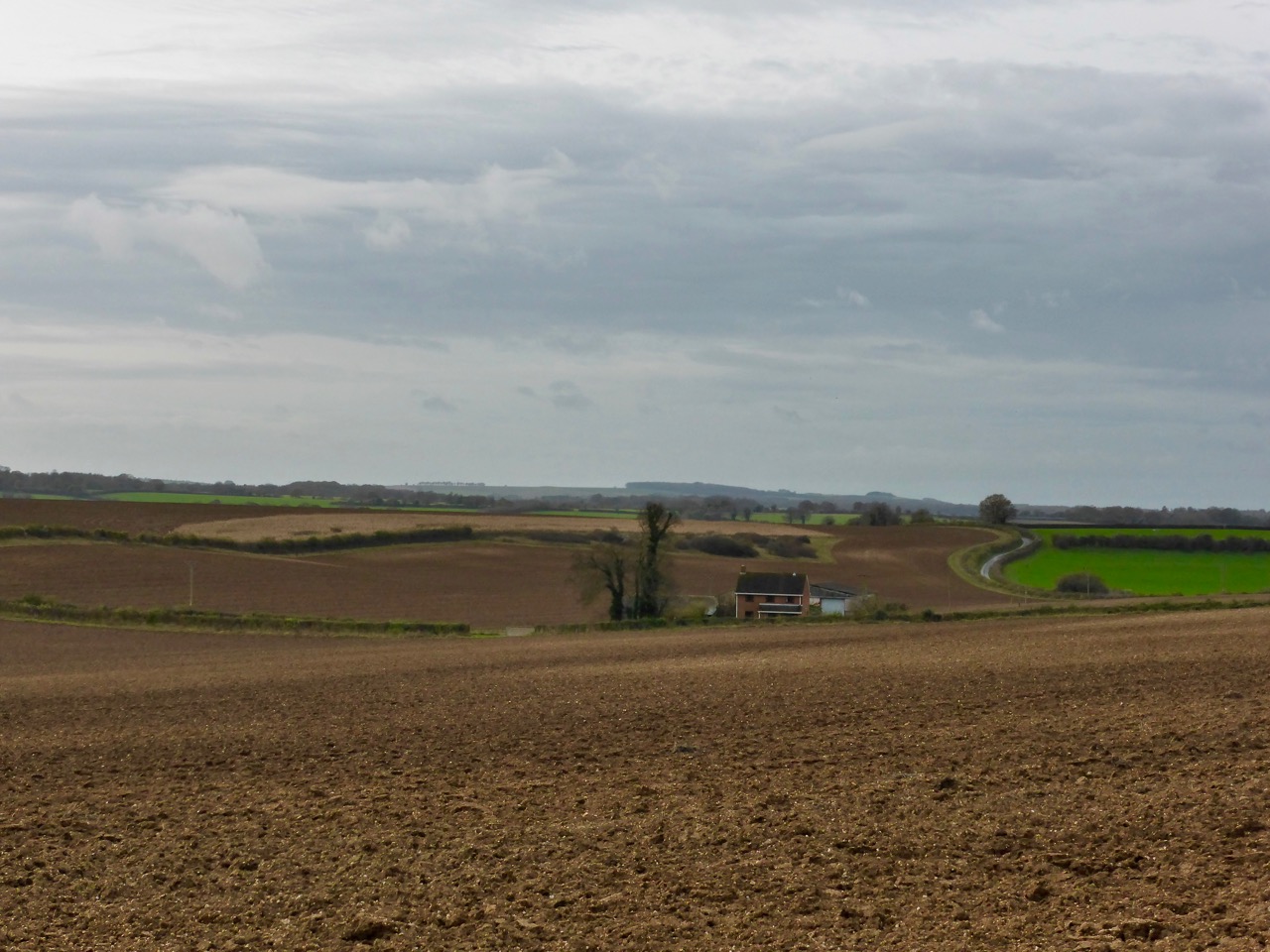
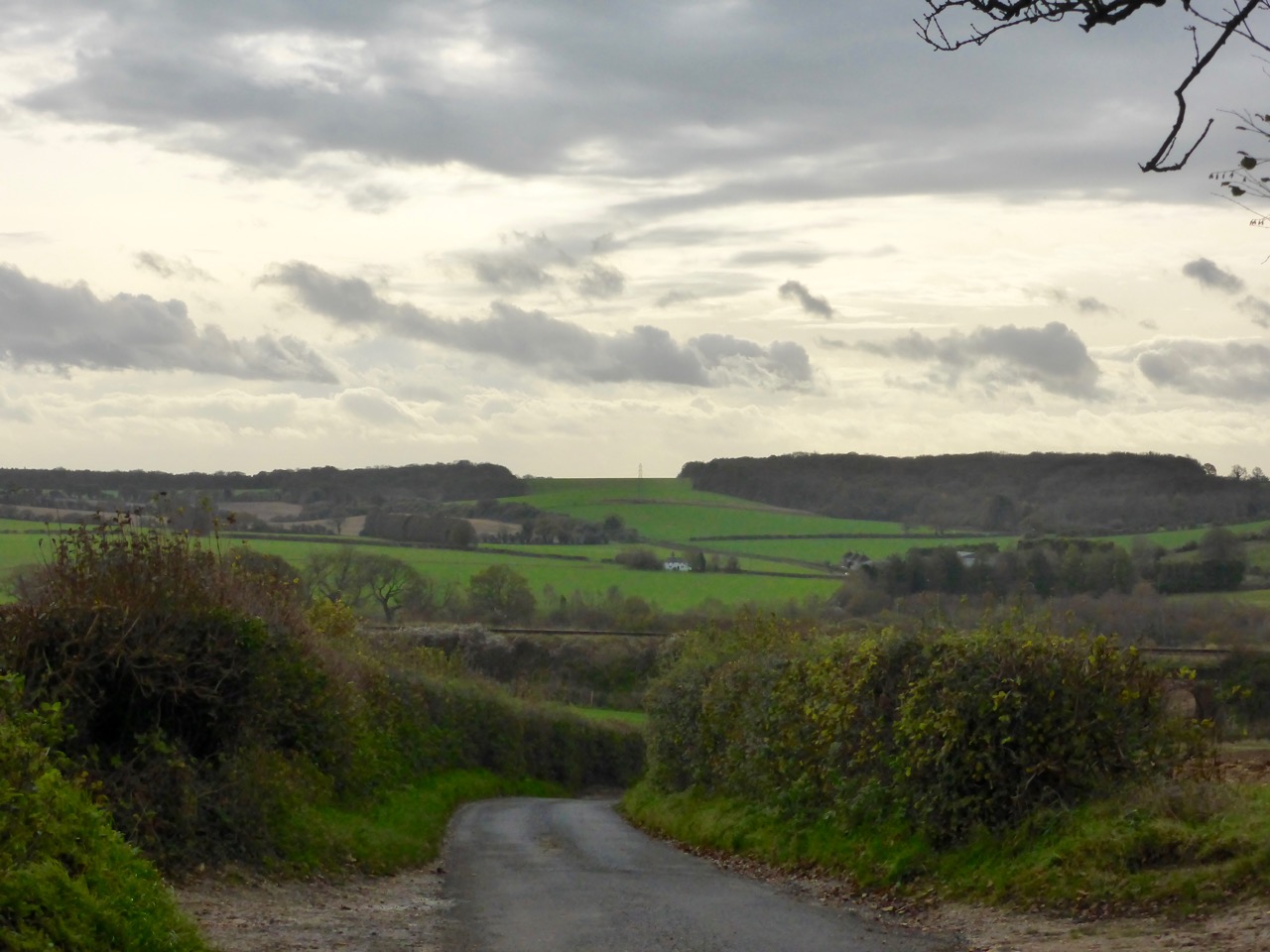
Looking south from Northside Lane to Park Dale and the woods of Bramdean Common:

Towards Park Dale and Bramdean Common

Back under the Watercress Line (ex Mid Hants Railway). Railway Bridge, Bishops Sutton, Watercress Line

The bridge arch. Always interesting patterns of decay on these bridges. This bridge would have been made around 1865. Just visible top right is one of two small trees we saw somehow growing from between the bricks:Railway Bridge, Bishops Sutton, Watercress Line

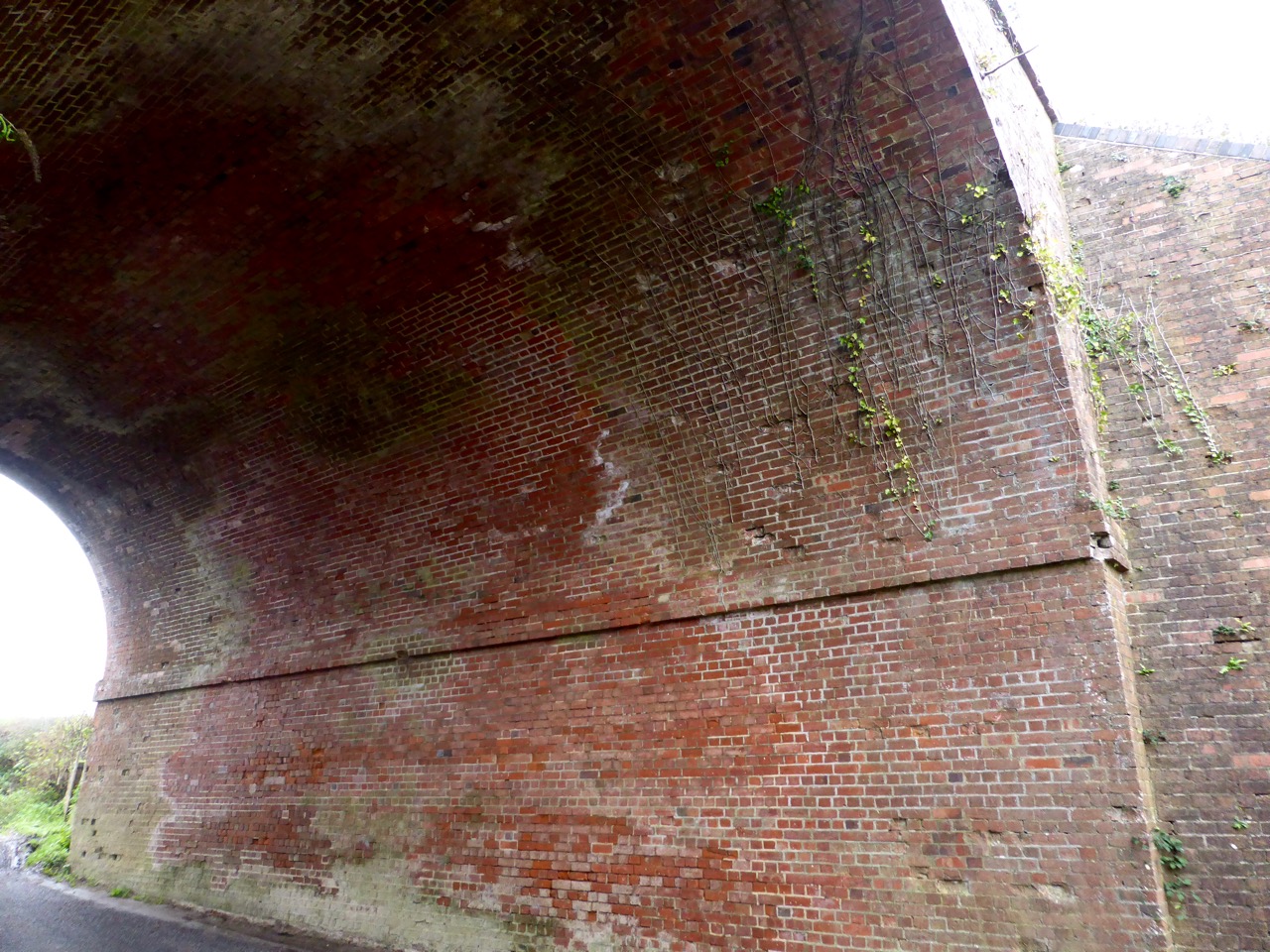
The site of the source of the short River Alre, which springs from east of Bishops Sutton and flows a few miles before joining the Itchen near Alresford. Source of the River Alre

Lots of crows! They were all on the field before we came.A Murder, Horde, Parcel, or Storytelling of Crows

Not quite *the* Alresford but a another Alres-ford (dry) at Water Lane, Bishops Sutton:Ford near Bishops Sutton

Milestone at Bishops Sutton. Apparently Winton is an abbreviation of Wintoniensis, the meaning of Winchester. Tasker is a 19th Century ironworks company.Milestone Bishops Sutton Winton 8

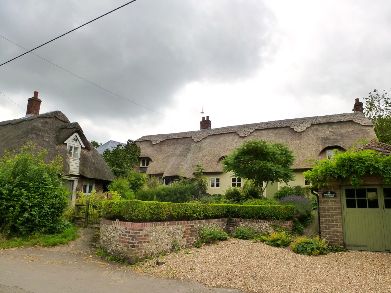
A typical row of Hampshire flint cottages, at Bishops Sutton.Flint cottages, Bishops Sutton

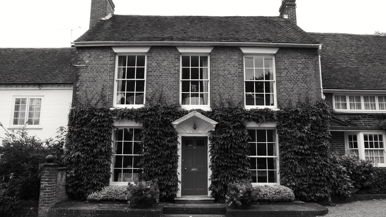
And the rather more fancy Sutton ManorSutton Manor

A glimpse of Bishops Sutton Church, with its high weathervane:Bishops Sutton Church

And right at the end of the walk we saw a bird of prey swoop across the road into the hedge. We stood and watched for a while before it went deeper in to eat its prey. Later we identified it as a kestrel:Kestrel with rat

Six years ago, I took a similar walk. Here is the video.

Weekend Walk 63 – Mill Barrow Down to Soberton – Wayfarers Walk

A proper South Downs Walk. Continuing along the long distance path from the downs south of Kilmeston, along a bit of the South Downs Way before cutting south past Lomer, Preshaw, the legendary Betty Mundy’s Bottom and Corhampton Down, noisy that day with the shooting. The path then heads in a more easterly direction past Corhampton golf course and onto Fir Down above Droxford. After the village we cross the River Meon and follow the water meadows to the small village of Soberton. Outside the White Lion pub I met a white cat, who I was told is deaf and blind.

Weekend Walk 62 – Alresford to Kilmeston Down – Wayfarers Walk

Into the South Downs National Park after heading south from the market town of New Alresford (my new home town). The Wayfarers Walk then passes through Tichborne, across the small at this stage River Itchen, Cheriton, Hinton Ampner, Kilmeston and then up onto Kilmeston Down for a spot of sheep herding, and Mill Barrow Down.

Weekend Walk 61 – Brown Candover to Alresford – Wayfarers Walk

Hampshire in the spring. A walk I took in April continuing the long distance path through the low downs of central Hampshire, nine miles or so from the Candover Valley to Alresford. The walk crosses the same stream many times, and passes by the villages of Totford, Northington and Abbotstone. The stream enters the very short river Arle which we see at the end of the walk with its ducks, swans (building a nest), geese and trout. Apologies for the wind noise.

Deane to Dummer – Wayfarers Walk – Weekend Walk 56

The fourth stage of my Wayfarers Walk hike. This walk is a loop, with the first half on the long distance path to Dummer, then back to Deane via North Waltham, Steventon, and Ashe. The source of the River Test is at Ashe. The walk crosses the mainline railway, the M3 and the A30.

Weekend Walk 54 – Highclere to Watership Down – Wayferers Walk

Here’s a video I made during the second stage of walking the 70 mile route across Hampshire. A high downs section with great views passing south of the Highclere Estate, home of Downton Abbey; Beacon Hill; Great Litchfield Down, Ladle Hill, leaving the long distance path at Watership Down, of book and film fame, for Sydmonton and Old Burghclere.

Hampshire Architecture – Portsmouth: Milton, Fratton, Hilsea (Listed Buildings)

The merest hints of the former villages of Milton, Fratton and Hilsea before they were swallowed by the rapid Victorian expansion of Portsmouth east and north, with a few old houses (including the TE Owen former vicarage opposite the impressive St Mary’s church, Gatcombe and Great Saltern houses). Otherwise, the listed buildings among the dense terraced houses are institutional: the former workhouse of St Mary’s House north of the hospital, cemetery chapels, C20 churches, the prison, Carnegie Library, and St James Hospital. Here I present the listed buildings in these areas. All photos taken in Feb 2014 by myself.


Hampshire Architecture – Portsmouth: Stamshaw (Listed Buildings)

A 19th Century dairy depot, a converted 20th Century church,  a couple of pubs, a smart row of townhouses reminiscent of Southsea, and that’s pretty much it for listed buildings in this area. The rest of west Portsmouth near the Motorway is row upon row of victorian terraces and post-war developments, among which these old and distinctive buildings can be found.

Hampshire Architecture – Hinton Ampner (Listed Buildings)

Hinton Ampner, together with Bramdean forms a parish midway between Winchester and Petersfield, close to and on the A272. For the purposes of  this post, here I am only posting photographs of the listed buildings in Hinton Ampner, with Bramdean to follow at some point. Hinton Ampner is dominated by the Hinton Ampner House estate, now owned by the National Trust. The house and many of the nearby cottages and farmhouse are rented from the Trust. Along the main road towards Bramdean are four further listed buildings including an old school built in the 1700s due to a will of William Blake (not the William Blake, I don’t think) and the old toll building, Turnpike House. Hinton Ampner House was built in 1790, remodelled in 1875 and 1936, and much of what we see today was rebuilt after a fire in 1960. Next to the house is All Saints church and just down the hill, Hinton House, the imposing former rectory. Several thatched cottages were built on the hill up from the main road, and at the top are two large farmhouses, Godwins and Manor Farmhouse. Many of the cottages date back to the 1500s.

Hampshire Architecture – Portsmouth: Mile End / Buckland (Listed Buildings)

There’s little pocket of Georgian and Victorian buildings hiding a few meters from the end of the motorway as you arrive in Portsmouth. 393 Old Commercial Road (the south end of Mile End Terrace) was the birthplace of Charles Dickens. Also nearby is All Saints Church next to the very busy roundabout and the former Market  Tavern, remodelled as accommodation for the ferry port just to the west.

Former Chapel Old Commercial Road Portsmouth 1885 387 and 389 Old Commercial Road Portsmouth c1800 379, 381 and 383 Old Commercial Road Portsmouth C19 Ferry House Lodge (Market House Tavern) Mile End Road Portsmouth c1840

393, 395, 397, 399 (Mile End Terrace) Old Commercial Road Portsmouth C18 393 (Charles Dickens Birthplace Museum) Old Commercial Road Portsmouth C18 391 Old Commercial Road Portsmouth C18

All Saints Church (North) Commercial Road Portsmouth 1827

All Saints Church Commercial Road Portsmouth 1827


Hampshire Architecture – Portsmouth: City Centre

Heavily bombed in the Second World War (and by a Zeppelin in the First) not so many Victorian or older buildings remain in this area of southern Landport. The photos below cover the University Quarter, Guildhall Walk and Square, Commercial Road (South) and West towards HMS Nelson. Mainly Victorian, the listed buildings are pubs, a former cinema, a theatre, assurance offices, banks, military and religious. Seemingly politics (Guildhall), finance (Prudential and Pearl), religion (the RC Cathedral and St Agathas), education (Park Building) and the military (Wardroom) compete for dominance of scale here. (Note that Park Building, behind the Guildhall, was covered in scaffolding today, so I used pictures I’d taken previously.)

Weekend Walk 50 – Ovington to Winchester – Allan King’s Way

The final stage of the King’s Way, along the Itchen Valley to Winchester, via Avington, Martyr Worthy, Kings Worthy, and Abbots Barton. The Itchen Valley always makes for a beautiful walk. Today’s was enhanced by meeting a couple of pigs. Many churches along the way, and I rested in some of them. I entered the Winchester from the north, via Hyde Gate and Parchment Street, the residential area seamlessly meeting the city centre. It’s always interesting arriving at a town or city on foot. The King’s Way ends at the Cathedral, after 45 miles in total.

Hampshire Architecture – Portsmouth: Eastney (Listed Buildings)

Eastney is at the south east corner of Portsea Island, meeting Southsea to the west and Milton to the north. Mainly residential with its late Victorian and early C20 terraces, the area near the coast is dominated by the large barracks built in the 1860s. These impressive military buildings are now apartments and the Royal Marines Museum. They were Designed by William Scamp of the Admiralty Works Department and include a water/clock tower, and the longest barrack block after Woolwich. DW Lloyd says:

The carefully laid-out site beside the seashore reflects its use by Marines; it is also probably the last large defensible barracks built in the country. Part of the best and most complete barracks of the post-Crimean War period.

Immediately to the east and west are the Eastney forts. Just to the north is the Portsmouth Pumping Station with its Beam Engine House and associated boiler room and other listed buildings on the site. Also included here, although really in Southsea, are the Eastfield Hotel (by pub architect AE Cogswell) and St Patrick’s church (a most unusual and appealing church by GE Smith). Being so different to the municipal and military architecture, these are shown first and then all of the listed buildings of Eastney (apart from Fort Cumberland.)

Eastfield Hotel (The Eastfield) Southsea 1906

St Patrick's Church (North) Southsea 1906

Walk: Ropley / Gilbert Street

Today we walked for an hour, maybe an hour and a half in the area of Gilbert Street, just north of the South Downs National Park. Gilbert Street sounds like a street. It isn’t, just part of the loosely connected settlements in the Ropley/Monkwood/North Street area, southwest of Alton.

From Ropely we crossed a vast hayfield to towards Lyewood House:

Hay Field, Round BalesDon’t play on the round bales we were told on their introduction in the 1980s. I preferred the rectangular ones we could build dens with.

Each field a whole other scene:Ropley area

Golden Barley Field

Views to the west, climbing higherHampshire view

In Little Down woodPond near Ropley

P1020982

Near Lyeway FarmNear Lyeway Farm

Cottage at Swelling HillCottage at Swelling Hill

Into Old Down WoodOld Down Wood

Down the hill to Gilbert StreetTowards Gilbert Street

On St Swithuns Way, passing sheep and horsesMale Sheep Horse Paddock

And back to the start at RopleyRopley Hampshire


A good walk with many changes of countryside within quite a small area.

Hampshire Architecture – Droxford

Droxford is a Hampshire village situated in the Meon Valley. It has the busy A32 running through the middle of it, with the river Meon just to the East along with the former Meon Valley Railway. Most of the old buildings are right on the main road, with some set back on Mill Lane and near the church. In the village you will find listed cottages and houses from the C15 to the C19, although mainly Georgian. Larger houses are the Manor House (II*), Fir Hill, West House and The Old Rectory (II*). Next to the river is the church, of Norman origin. Out of the village are some listed farmhouses, barns and their C18 granaries.

Here I present all of the listed buildings in the parish, except for a couple of barns that I couldn’t get access to. Thank you to all the property owners who gave me permission to photograph. My favourites today are The Malt House and Mill Cottage, appearing first.

The Malt House Droxford C18 Mill Cottage Droxford C16

Weekend Walk 49 – Gander Down to Ovington – Allan King’s Way

The penultimate stage of my King’s Way hike, from where I left off on the Downs, not too far from Cheesefoot Head, down into the Itchen Valley via Tichborne. The church there has 11th Century origins, and at Ovington church there’s a Norman archway. Otherwise, rolling downland, open skies, arable land ready for harvest, curious calves, a gorgeous pub location, lamas, woods, then the bass and slight chaos of the Boomtown Fair at Mattersley Bowl, closing some of the South Downs Way for a week.