The final stage of the Wayfarer’s Walk, filmed in July 2019, from Portsdown Hill to Emsworth. The walk passes through Bedhampton before meeting the coast at Brockhampton, and along to Langstone and Warblington.
The final stage of the Wayfarer’s Walk, filmed in July 2019, from Portsdown Hill to Emsworth. The walk passes through Bedhampton before meeting the coast at Brockhampton, and along to Langstone and Warblington.
From the downland village of Hambledon, through Denmead and the eastern edge of the Forest of Bere, the path then slowly climbs the north side of Portsdown Hill near Widely.
Unfortunately my camera didn’t record the views from the hop overlooking Portsea Island, so I used a couple of pics found online to illustrate the hazy scene that day.
Six months after the west section, here is the video for the eastern part of the Oxdrove Way
I started back in Old Alresford and proceeded in a 22km loop around Abbotstone Down, Bradley, Lower and Upper Wield and back over classic downland. The walk follows ancient green lanes and ox droves and is often contained within tree tunnels.
In January, on a cold, clear day, I walked the western part of the Oxdrove Way. For one reason or another, I only just round to editing it. The eastern section follows soon.
The Oxdrove Way is a 25-mile looped long distance path in mid-Hampshire. I started in Old Alresford and headed west, above the Itchen Valley to Itchen Wood and the M3, then back over downland via Abbotstone. Much of the walk follows old cattle droves or green lanes.
Scenes during a walk in late autumn, from Bishops Sutton near Alresford, to Gundleton and back.
An old granary at the northern edge of Bishops Sutton, perched on staddlestones to keep it drier and relatively rodent-proof:

A new house (Southview) built next to the Watercress Line. This is looking west:
Watercress line from Bighton Lane, looking east: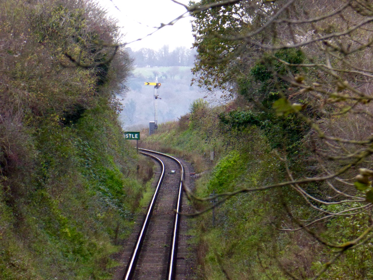
A dovecote in a scruffy garden near the railway: 
View from Bighton Lane to Northside Farm and Sutton Wood:
Geese and cows at Cliveden Farm, Gundleton:
Cliveden. And I thought all of this part of Hampshire was super-expensive:
Feeding the horses near Gundleton. They were very hungry. C fetched them fresh grass and I pushed the fallen hay to their side of the fence: 
Into an autumnal Sutton Wood:

Out of the wood, looking west. The familiar landmark of Great Clump, Cheesfoot Head in the distance: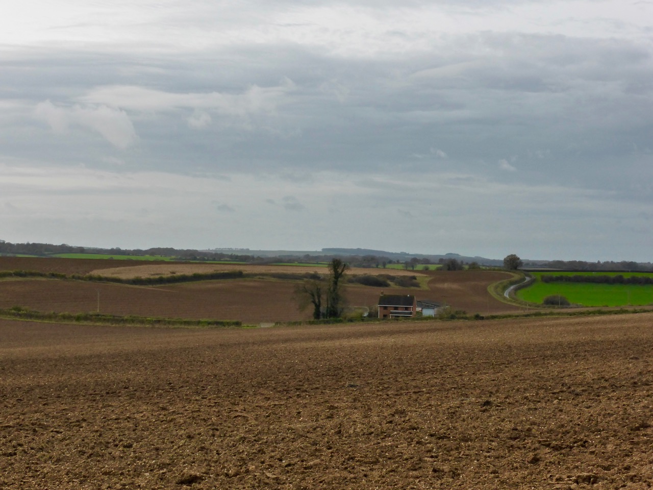
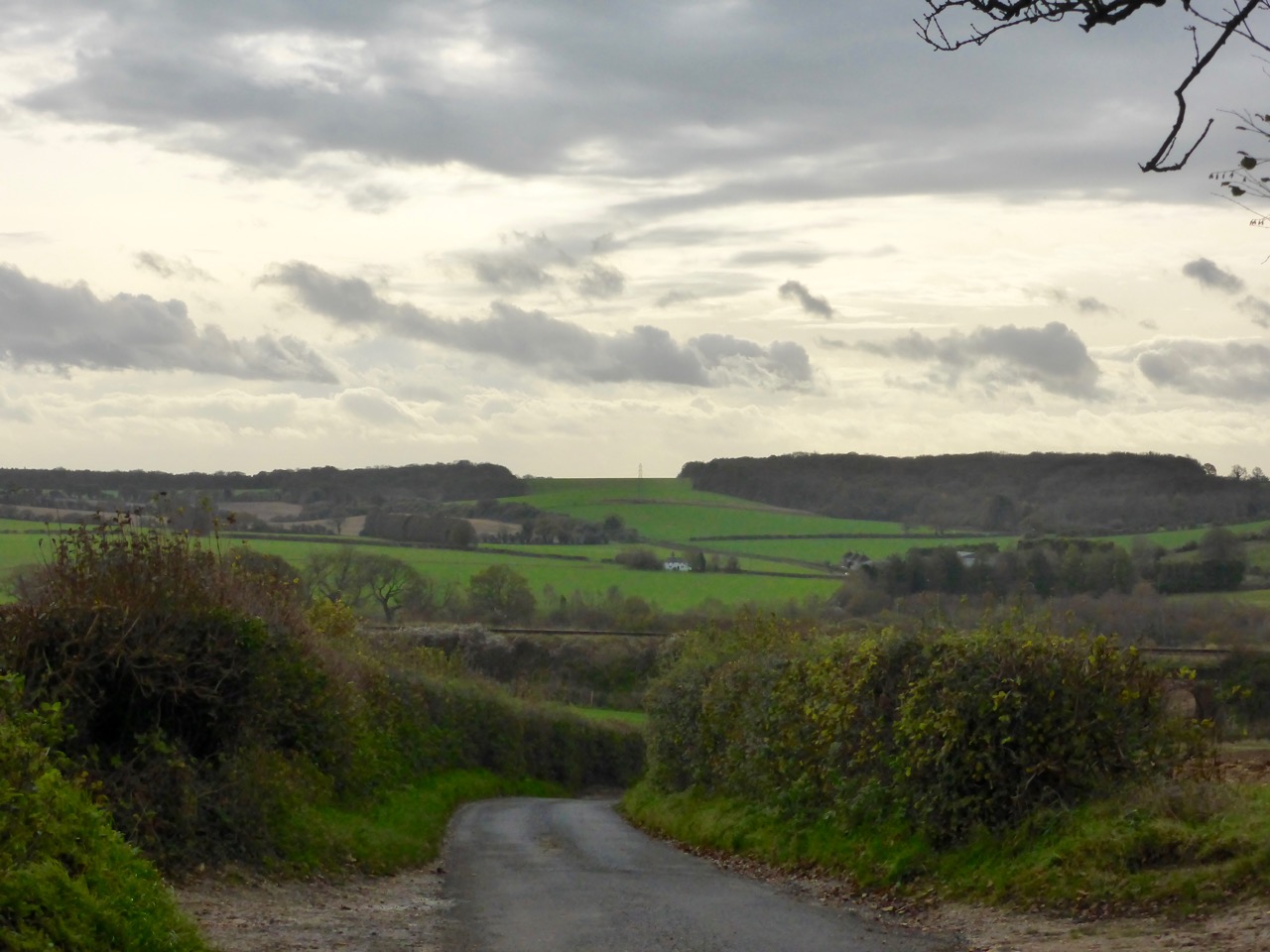
Looking south from Northside Lane to Park Dale and the woods of Bramdean Common:
Back under the Watercress Line (ex Mid Hants Railway). 
The bridge arch. Always interesting patterns of decay on these bridges. This bridge would have been made around 1865. Just visible top right is one of two small trees we saw somehow growing from between the bricks: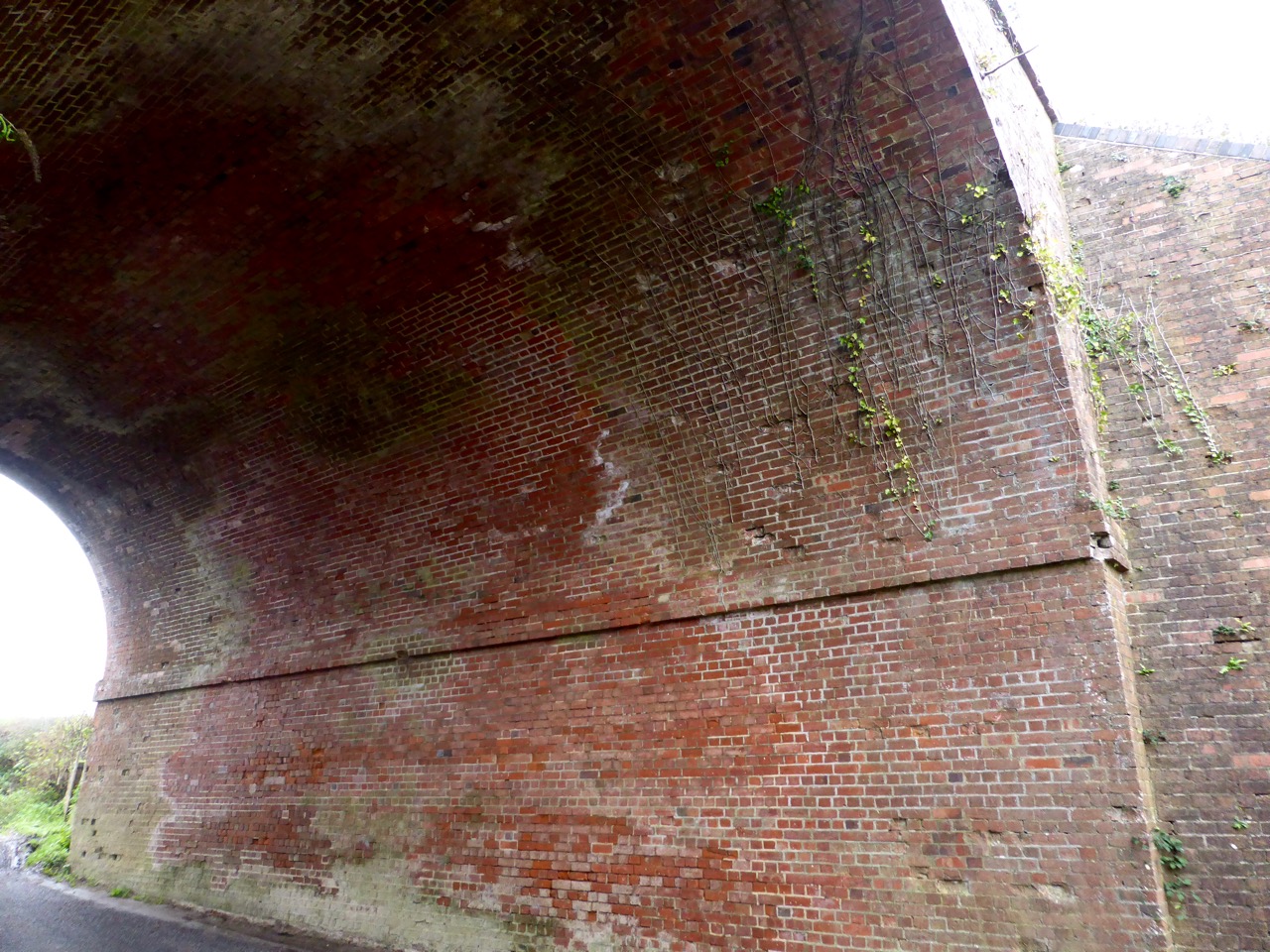
The site of the source of the short River Alre, which springs from east of Bishops Sutton and flows a few miles before joining the Itchen near Alresford. 
Lots of crows! They were all on the field before we came.
Not quite *the* Alresford but a another Alres-ford (dry) at Water Lane, Bishops Sutton:
Milestone at Bishops Sutton. Apparently Winton is an abbreviation of Wintoniensis, the meaning of Winchester. Tasker is a 19th Century ironworks company.
A typical row of Hampshire flint cottages, at Bishops Sutton.
And the rather more fancy Sutton Manor
A glimpse of Bishops Sutton Church, with its high weathervane:
And right at the end of the walk we saw a bird of prey swoop across the road into the hedge. We stood and watched for a while before it went deeper in to eat its prey. Later we identified it as a kestrel:
Six years ago, I took a similar walk. Here is the video.
A proper South Downs Walk. Continuing along the long distance path from the downs south of Kilmeston, along a bit of the South Downs Way before cutting south past Lomer, Preshaw, the legendary Betty Mundy’s Bottom and Corhampton Down, noisy that day with the shooting. The path then heads in a more easterly direction past Corhampton golf course and onto Fir Down above Droxford. After the village we cross the River Meon and follow the water meadows to the small village of Soberton. Outside the White Lion pub I met a white cat, who I was told is deaf and blind.
Into the South Downs National Park after heading south from the market town of New Alresford (my new home town). The Wayfarers Walk then passes through Tichborne, across the small at this stage River Itchen, Cheriton, Hinton Ampner, Kilmeston and then up onto Kilmeston Down for a spot of sheep herding, and Mill Barrow Down.
Hampshire in the spring. A walk I took in April continuing the long distance path through the low downs of central Hampshire, nine miles or so from the Candover Valley to Alresford. The walk crosses the same stream many times, and passes by the villages of Totford, Northington and Abbotstone. The stream enters the very short river Arle which we see at the end of the walk with its ducks, swans (building a nest), geese and trout. Apologies for the wind noise.
The fifth stage of my Wayfarers Walk route, from the village of Dummer near Basingstoke, to Brown Candover in the heart of Hampshire. The walk goes over Becket’s Down, giving fine views over southern Hampshire.
An almost-loop at the very western edge of the South Downs National Park. From Magdalen Hill east of Winchester, up towards Cheesefoot Head and then across the downs to Morestead. Then down into Chilcombe through the firing range and finally across the M3 into Winchester via The Soke.
The fourth stage of my Wayfarers Walk hike. This walk is a loop, with the first half on the long distance path to Dummer, then back to Deane via North Waltham, Steventon, and Ashe. The source of the River Test is at Ashe. The walk crosses the mainline railway, the M3 and the A30.
Leaving the high downs and headed south east, deeper into Hampshire, passing by North Oakley in this sparsely populated area.
Here’s a video I made during the second stage of walking the 70 mile route across Hampshire. A high downs section with great views passing south of the Highclere Estate, home of Downton Abbey; Beacon Hill; Great Litchfield Down, Ladle Hill, leaving the long distance path at Watership Down, of book and film fame, for Sydmonton and Old Burghclere.
The first five miles of the 70-mile Wayfarer’s Walk long distance path. This hike is high on the North Wessex Downs, starting near Walbury Hill, the highest point in Southern England at nearly 300m. The path leads south east from Berkshire into Hampshire, past West Woodhay Down, Eastwick and Highclere, where I turned back. Half way back I left the Wayfarer’s Walk for Combe and around from the south to Combe Gibbet and Inkpen Hill. Features a view of Highclere Castle, location for Downton Abbey and fine views north. Filmed last Saturday.
A circular walk along the River Itchen and the Itchen Navigation, from St Cross south to Hockley Viaduct, now open for walkers and cyclists, back north to Winchester city centre, cathedral and college before returning through the water meadows. Calves, newborn lambs and views of St Catherine’s hill.
The merest hints of the former villages of Milton, Fratton and Hilsea before they were swallowed by the rapid Victorian expansion of Portsmouth east and north, with a few old houses (including the TE Owen former vicarage opposite the impressive St Mary’s church, Gatcombe and Great Saltern houses). Otherwise, the listed buildings among the dense terraced houses are institutional: the former workhouse of St Mary’s House north of the hospital, cemetery chapels, C20 churches, the prison, Carnegie Library, and St James Hospital. Here I present the listed buildings in these areas. All photos taken in Feb 2014 by myself.
 Hilsea Portsmouth 1780 & 1887")


 Hilsea Portsmouth C16-19")
 Hilsea Portsmouth C16-19")

 Milton Portsmouth 1878")


 247 Fratton Rd Portsmouth 1899-1907")
 (South) 247 Fratton Rd Portsmouth 1899-1907")
")
 Fratton Portsmouth 1889")


 Portsmouth 1911")


 Milton Portsmouth 1845")
 Milton Portsmouth 1845")

 Milton Portsmouth 1915")
 Milton Portsmouth 1915")


A 19th Century dairy depot, a converted 20th Century church, a couple of pubs, a smart row of townhouses reminiscent of Southsea, and that’s pretty much it for listed buildings in this area. The rest of west Portsmouth near the Motorway is row upon row of victorian terraces and post-war developments, among which these old and distinctive buildings can be found.


 Portsmouth 1900")

 Portsmouth 1916")


Hinton Ampner, together with Bramdean forms a parish midway between Winchester and Petersfield, close to and on the A272. For the purposes of this post, here I am only posting photographs of the listed buildings in Hinton Ampner, with Bramdean to follow at some point. Hinton Ampner is dominated by the Hinton Ampner House estate, now owned by the National Trust. The house and many of the nearby cottages and farmhouse are rented from the Trust. Along the main road towards Bramdean are four further listed buildings including an old school built in the 1700s due to a will of William Blake (not the William Blake, I don’t think) and the old toll building, Turnpike House. Hinton Ampner House was built in 1790, remodelled in 1875 and 1936, and much of what we see today was rebuilt after a fire in 1960. Next to the house is All Saints church and just down the hill, Hinton House, the imposing former rectory. Several thatched cottages were built on the hill up from the main road, and at the top are two large farmhouses, Godwins and Manor Farmhouse. Many of the cottages date back to the 1500s.


 1717")


 1790, 1875, 1937")


 1790, 1875, 1937")
 1790, 1875, 1937")
 1790, 1875, 1937")

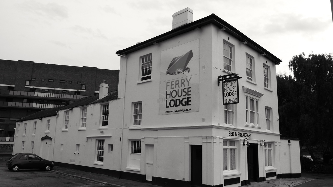
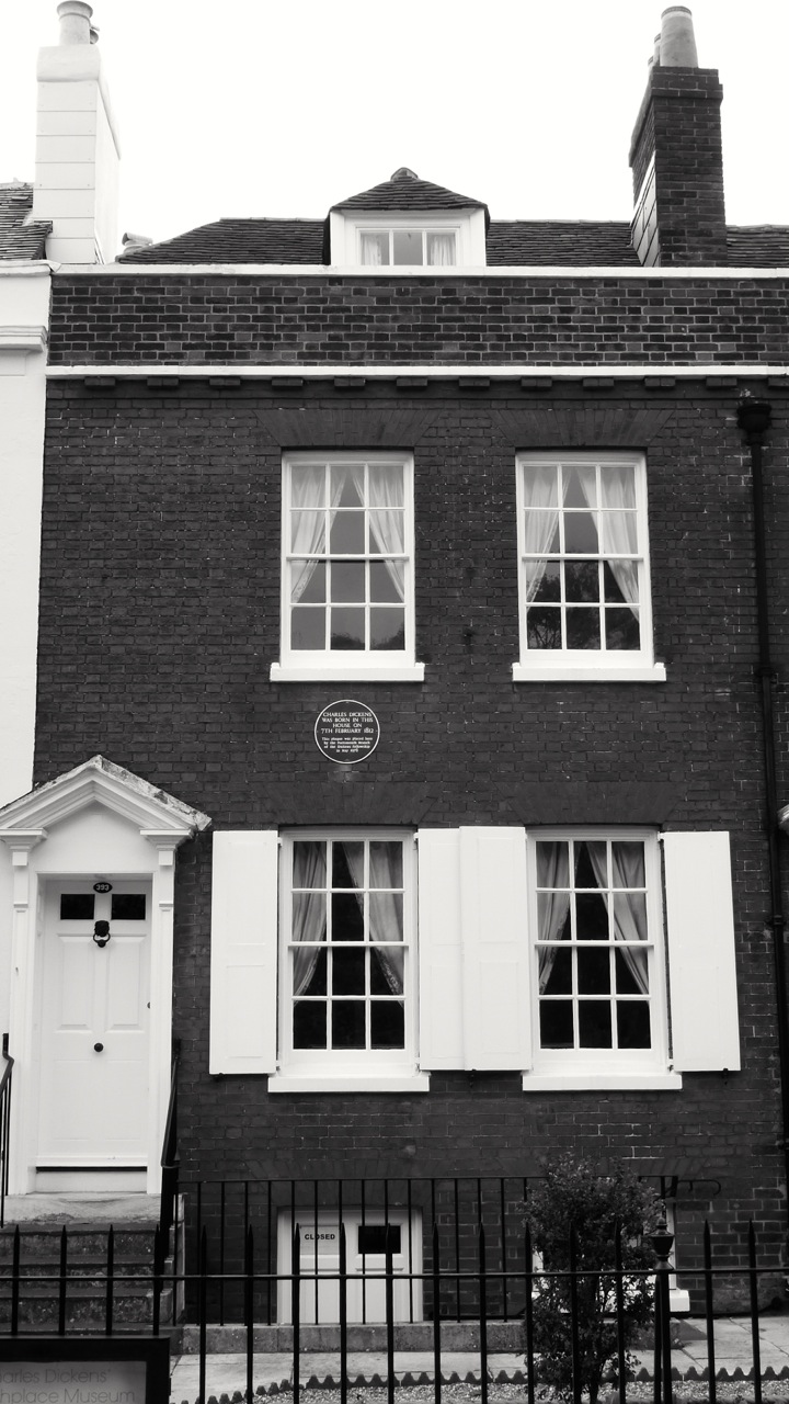
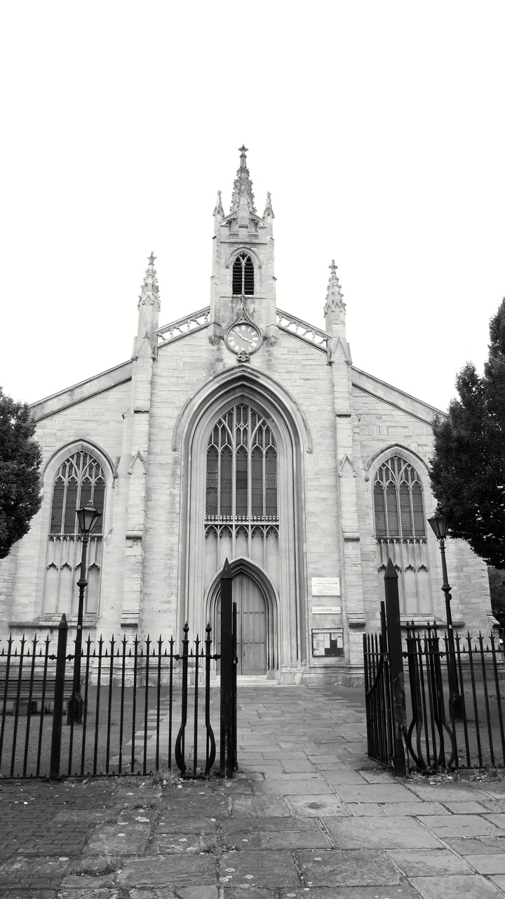
There’s little pocket of Georgian and Victorian buildings hiding a few meters from the end of the motorway as you arrive in Portsmouth. 393 Old Commercial Road (the south end of Mile End Terrace) was the birthplace of Charles Dickens. Also nearby is All Saints Church next to the very busy roundabout and the former Market Tavern, remodelled as accommodation for the ferry port just to the west.


Heavily bombed in the Second World War (and by a Zeppelin in the First) not so many Victorian or older buildings remain in this area of southern Landport. The photos below cover the University Quarter, Guildhall Walk and Square, Commercial Road (South) and West towards HMS Nelson. Mainly Victorian, the listed buildings are pubs, a former cinema, a theatre, assurance offices, banks, military and religious. Seemingly politics (Guildhall), finance (Prudential and Pearl), religion (the RC Cathedral and St Agathas), education (Park Building) and the military (Wardroom) compete for dominance of scale here. (Note that Park Building, behind the Guildhall, was covered in scaffolding today, so I used pictures I’d taken previously.)

 Portsmouth University 1908")


 Portsmouth 1889")


 Guildhall Walk Portsmouth 1897")

 Guildhall Walk Portsmouth 1920")


 1890")
 1890")
 Guildhall Walk Portsmouth C19")


 Portsmouth 1901")

 Portsmouth C19")

")
 Portsmouth 1881")

 Portsmouth 1881")


